Skip to Main Navigation

Urbanization in East Asia - Explore a New Data Set

Submit your ideas for new research using our data

The World Bank invites researchers, academics, designers, students, and practitioners from around the world to explore and use the World Bank’s recently released dataset on urban spatial expansion in the East Asia and Pacific (EAP) region.

We are seeking entries for two tracks: (1) research proposals and (2) data visualizations. This page provides details on the research proposal track only. You can find information about the data visualization challenge at Visualizing.org.

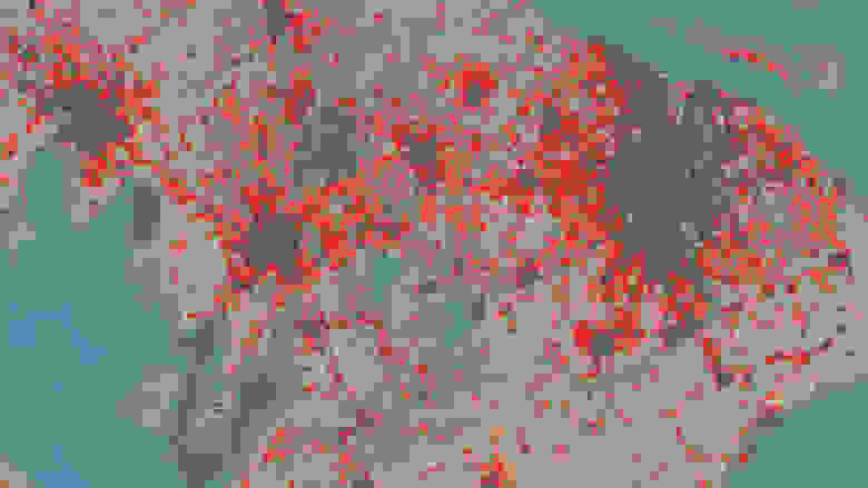
The rapid urbanization of East Asia is one of the most transformative global phenomena of our generation, with far-reaching economic, political and environmental implications. As part of its study on urban expansion in East Asia, the World Bank has mapped urbanization across the region using satellite imagery.

The World Bank’s unique database is a complete map of built-up areas across the East Asia region (stretching from Mongolia to the Pacific Islands) for the years 2000 and 2010, combined with a population distribution map. The dataset, which includes data on all 869 urban areas in the region with populations over 100,000, is a treasure trove of changing patterns of urbanization in recent years. The data also include maps for five cities with more detailed land use classifications, using ~10m resolution satellite imagery. The World Bank’s new report entitled East Asia’s Changing Urban Landscape – Measuring a Decade of Spatial Growth (www.worldbank.org/eap/MeasuringUrbanExpansion) outlines the findings of this study for the region and per country.

   Data

Data can be downloaded here

East Asia and Pacific region-wide data (select dataset 'Urban Expansion 2000-2010'):

  • Shapefiles of administrative boundaries, showing built-up areas and population mapped to those areas in c2000 and c2010, downloadable by country (.shp).
  • Raster maps showing built-up areas for c2000 and c2010, downloadable by country (.tif).
  • Tables showing urban land and urban population by country and by individual urban area (.xls).

Five cities in detail (select dataset 'PUMA Land Use'):

  • Land use/land cover maps for Surabaya (Indonesia), Ho Chi Minh City and Hai Phong (Vietnam), Cebu (Philippines), and Ulaanbaatar (Mongolia), for c2000 and c2012, using GMES (European Urban Atlas) land cover classifications (.shp)

Important notes on definitions:

  • ‘Urban areas’ as defined in these data are not delimited by administrative boundaries. As explained in the readme.txt file, urban areas can be grouped using the ‘WB_agglom’ field in the administrative boundary shapefiles. Entries that combine data on ‘urban areas’, as defined here, with data on ‘cities’ or ‘metropolitan areas’ defined differently, without adjustment, may be considered misleading and judged accordingly.
  • Similarly, urban populations in this study are measured differently from national statistical agencies, which means national urban population figures here differ from those reported by the United Nations World Urbanization Prospects, which uses national definitions, and consequently on the World Bank Open Data website, which draws from UN statistics.

Additional Data: 

Entrants are encouraged to incorporate other data sets into the analysis, but the use of the East Asia urban spatial expansion data described above must be integral to the proposed research. The proposed research should not be possible to conduct in the absence of this data set. Analysis can be performed at the regional, national, or city level. Entrants are encouraged to familiarize themselves with the analysis of this data set already presented in the report East Asia’s Changing Urban Landscape – Measuring a Decade of Spatial Growth to avoid repetition.

Additional open data sets that can be used include (but are not limited to) those available from the World Bank’s Open Data site (data.worldbank.org). (Please note differences in definitions between urban data from this study and those in other data sets, as explained above). Submissions must specify the terms of use of any additional data.

   Submission Guidelines

To submit, click on “Your Feedback” on the right, and then on the "Submissions" tab on the feedback wall page. [Note that as the deadline for submissions has now passed, we have disabled the Submissions channel.]

Please submit the following information.

  • Title of Proposed Paper:
  • Name and Affiliation(s) of Author(s):
  • Email address:
  • World Bank urban spatial data used (see above):
  • Other Datasets Used (please specify sources):
  • Research Question (limit 150 words): What question are you planning to answer through your analysis? What hypothesis are you planning to test?
  • Research Abstract (limit 500 words): Expand on the research question – what are the possible policy implications of your findings? What methodology will be applied for the analysis? How will you combine the World Bank EAP Urban Spatial Expansion data with other datasets for the analysis?

Eligibility: Entrants may be individuals or teams. World Bank Group staff, including its consultants, contractors and their employees are not eligible. Additional eligibility guidelines may apply for the visualization competition (see Visualizing.org page). All visualizations, proposals and papers must be in English.

Jurors:  Proposals will be reviewed by a panel composed of staff of the World Bank and partner organizations, including the United Nations Population Division and the University of Southampton's WorldPop Project. Finalists will be invited to submit a full paper. In the second round, jurors from these organizations will select 3 winning papers from among the finalists.

Applicants will be notified by the end of March 2015 whether their abstracts have been selected as finalists.

Criteria for Selection:

Paper proposals will be judged on the following criteria:

  • Clarity (10 points): How clear is the paper proposal abstract?
  • Impact: (10 points): Is the proposed research likely to help policymakers and development practitioners understand an issue related to urbanization in a new way, or bring an important urban development issue into focus?
  • Methodology/technical rigor (10 points): How suitable is the proposed methodology for answering the research question?

Finalists will be asked to submit a full paper (based on their abstract) by June 1, 2015. Completed papers should be a maximum of 5,000 words.

Winners: Three winners will be invited to present their paper at the World Bank headquarters in Washington, DC, at an event chaired by senior World Bank staff. Economy class travel to Washington, DC and two nights’ accommodation for one person per winning entry will be covered by the World Bank.

Notes:

The data are made available via the Creative Commons Attribution license (CC BY 3.0 IGO). Please also refer to the terms and conditions on the PUMA web page.

Jury deliberations are confidential and immune from appeal.

By participating, entrants agree to present their work publicly should they win, though they may decide whether and how to publish their full papers. Participants must make their own visa arrangements to travel to the United States, where necessary. The World Bank cannot guarantee visa applications will be approved.

Please send any questions to: EastAsiaUrbanData@worldbank.org